When Did Antarctica Become a Continent?
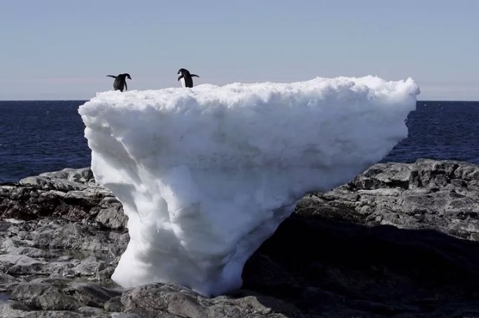
Antarctica is Earth’s southernmost continent. Its thick ice sheet hides a long geological record, from ancient continental crust to the ocean gateways that now surround the landmass.
Its separation involved several distinct stages. Antarctica was once connected to other landmasses within Gondwana. There is no single date when Antarctica became isolated, because continental breakup, the opening of ocean gateways and climatic isolation happened at different times.
Antarctica covers more than 14 million square kilometres, but most of its geology is hidden beneath ice. Exposed rock outcrops, mountain ranges and marine sediments provide clues to the continent’s long history.
Scientists have mapped only a small fraction of Antarctica’s exposed bedrock. Geophysical surveys, ice cores, rock samples and marine sediments help researchers reconstruct the geology hidden beneath the ice.
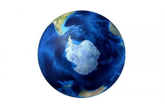
The Transantarctic Mountains form a major divide between East and West Antarctica. Much of the range is covered by ice, while exposed rock outcrops provide clues to the continent’s geological history.
Much of East Antarctica is underlain by ancient cratonic crust, a stable block of continental lithosphere. Some East Antarctic rocks are more than three billion years old. West Antarctica has a more complex crustal structure, with several tectonic blocks and generally younger geological features.
Gondwana assembled over a long interval as ancient continental blocks came together during the late Precambrian and early Paleozoic. It later formed the southern part of Pangaea, the supercontinent that brought together most of Earth’s landmasses. Pangaea began to break apart around 200 million years ago, with northern Laurasia and southern Gondwana among the major landmasses that developed during the breakup.
During the Jurassic and Early Cretaceous, Gondwana broke apart in stages. The process eventually separated the landmasses that became Antarctica, Africa, South America, Australia and India, although rifting and seafloor spreading began at different times along different margins. Matching rock units and geological structures on continents now far apart help scientists reconstruct these former connections.
A 2006 modeling study showed that the Antarctic was warmer than it was today during the Mesozoic (252 million to 66 million years ago) and had temperate rainforests full of dinosaurs and other ancient life during the Cretaceous (145 million to 66 million years ago). The region served as a key southern gateway, and for tens of millions of years, South America and the Antarctic and Australia remained interconnected, allowing plants and animals to disperse throughout the region.
For example, fossil evidence shows that marsupials originated at least 125 million years ago in North America and moved south toward South America and east across the Antarctic before arriving in Australia at least 55 million years ago.
The timing depends on which stage of separation is being discussed. Rifting began before the deep ocean gateways opened, and shallow connections may have persisted after the continents started moving apart.
Scientists therefore distinguish between the start of rifting, the first marine passage and the later opening of deep ocean gateways. These events occurred at different times, so studies may use different dates depending on the geological milestone they examine.
Most recent research shows that the Drake Passage (between Antarctica and South America) and the Tasmanian Gateway (between Antarctica and Australia) opened in stages; deeper ocean connections developed roughly 34–30 million years ago, although the exact sequence and timing remain debated. As Australia moved north and Antarctica moved south, the gateways gradually widened. As these gateways deepened, they helped establish the Antarctic Circumpolar Current, which flows around Antarctica and reduces the direct exchange of warmer low-latitude waters with the Southern Ocean. A major expansion of the East Antarctic ice sheet occurred around the Eocene–Oligocene transition, about 34 million years ago, as global cooling and changing ocean circulation combined. The opening of these ocean gateways was part of a much longer breakup of Gondwana and a wider sequence of changes in Southern Ocean circulation.
Antarctica plays a major role in the global climate system. Its bright snow and ice reflect much of the incoming sunlight, while the ice sheet stores a vast amount of freshwater. Warming can thin ice and reduce surface reflectivity in some areas, amplifying regional warming; changes in land ice can also contribute to sea-level rise. The pace and pattern of change vary across the continent and are influenced by both the atmosphere and the surrounding ocean.
Floating ice shelves extend from grounded glaciers over the ocean and can fracture or calve icebergs. Because they already float, their immediate loss adds little directly to sea level. However, ice shelves can restrain the glaciers behind them; if that buttressing weakens, grounded ice can flow faster into the ocean and contribute to sea-level rise.
Scientists study Antarctic ice cores, rocks and marine sediments to reconstruct past climates and understand how the ice sheet and Southern Ocean may respond to future warming. For related context, read our guides to climate change and the geological history of Earth’s oceans.
Sources and further reading
- British Antarctic Survey: Paleogene opening of Drake Passage.
- Scher et al., Nature: Onset of the Antarctic Circumpolar Current and the Tasmanian Gateway (2015).
- U.S. Geological Survey: Tectonics of Antarctica.
- U.S. Geological Survey: Geological boundary between East and West Antarctica.