When did the Antarctic become a continent?
The Antarctic is a frozen land today; But at one time the continent was not isolated from other lands and had different climatic conditions.
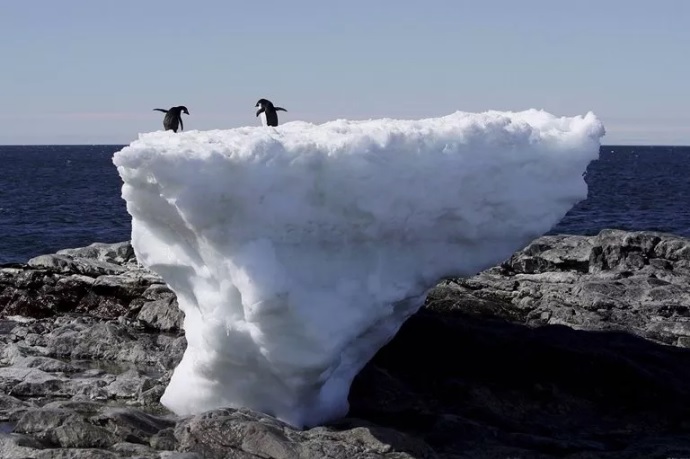
Antarctica, the fifth largest continent on Earth, is often known for breaking penguins and huge ice rigs and unsuccessful voyages; But this icy land at the bottom of the earth was not always so isolated and was once part of a large supercontinent. So when did the Antarctic become an independent continent?
Today, the Antarctic is the largest chunk of ice on Earth, covering more than 14 million square kilometres. Antarctic cliffs hidden beneath the ice reveal the continent’s dynamic history. Libya Ives, PhD candidate in Earth Sciences at the University of Wisconsin in Milwaukee, said:
Antarctica is like any other continent and has a variety of landscapes (mountain ranges, valleys, and plains) all shaped by its geological history. Much of this geological history remains unknown; Because less than one percent of the continent has bare rocks that can help us unravel its story.
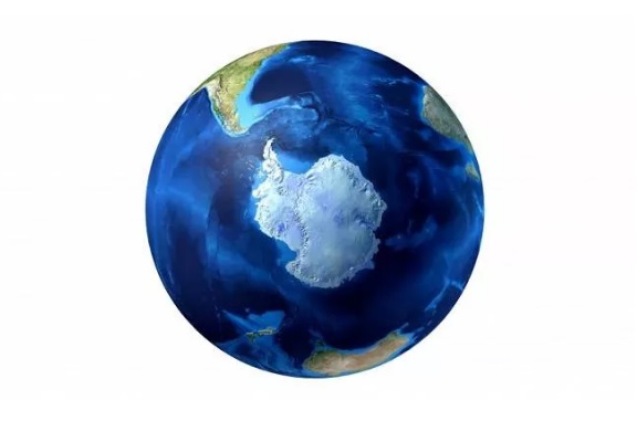
Many of the visible rocks in the Antarctic are part of the Antarctic Mountains, which reach a height of about 4,500 meters or higher in the Rocky Mountains of North America. This vast continent is divided into eastern and western parts.
According to geologists, the southeast is a craton; That is, the ancient continental block of the earth’s crust and the highest part of the mantle, which is composed of igneous, sedimentary and metamorphic rocks, some of which are more than 3 billion years old. The Antarctic, on the other hand, is relatively young and is composed mostly of volcanic rocks that formed in the ring of fire around the time the Gondwana supercontinent began to break during the Jurassic period (3.201 million to 145 million years ago).
Gondwana has ancient roots. This supercontinent was created about 600 million years ago at the end of the Ediac period, before Pangea (archetype) even existed. Pangea began to break into two large fragments about 200 million years ago, forming the Laurasia supercontinent in the north and Gondwana in the south.
About 180 million years ago, Gondwana, which included parts of Antarctica, Africa, Australia, India, and modern-day South America, began to divide, creating continental parts that are more familiar to us today. According to Discover Antarctica, the basaltic rocks found on the eastern edge of the Antarctic correspond to those found in South Africa, indicating early fractures in Gondwana.
A 2006 modeling study showed that the Antarctic was warmer than it was today during the Mesozoic (252 million to 66 million years ago) and had temperate rainforests full of dinosaurs and other ancient life during the Cretaceous (145 million to 66 million years ago). The region served as a key southern gateway, and for tens of millions of years, South America and the Antarctic and Australia remained interconnected, allowing plants and animals to disperse throughout the region.
For example, fossil evidence shows that marsupials originated at least 125 million years ago in North America and moved south toward South America and east across the Antarctic before arriving in Australia at least 55 million years ago.
Scientists are unsure when the Antarctic broke away from other continents and lost its land connections to Australia and South America. “The paleontologist at the Carnegie Museum of Natural History in Pittsburgh,” said Matt Lamanna, a paleontologist.
The answer depends on what you mean by continental secession. Is this the first time that seawater has flowed between two land masses that were previously connected; Even if land species could still be easily dispersed between those areas, or do you mean when the ocean or sea became so wide and deep that it became very difficult to disperse the species?
Most recent research shows that the Drake Pass (between Antarctica and South America) and the Tasman Pass (between Antarctica and Australia) were created when the Eocene period ended and the Oligocene began about 34 million years ago. After the final fracture, Australia headed north; As the Antarctic began to move south. With the opening of the Drake Pass and the Tasman Pass between the continents, cold water flowed around the Antarctic, separating the continent from the warm ocean currents. At the bottom of the earth, the Antarctic began to freeze. “The opening of the Drake and Tasmanian crossings helped create the Antarctic Current,” Ives told LiveScience. “These were the last events in the disintegration of Gondwana.”
Today, the Antarctic plays a key role in the Earth’s climate system. The huge ice sheets that cover the continent reflect sunlight and keep the continent cool. Of course, as the earth warms due to climate change, the ice sheet melts and more rocks are revealed for study; But it also reflects less sunlight and enhances global warming.
Also, ice sheets spread over land on adjacent waters such as the Southern Ocean, the Weddell Sea, and the Ross Sea, forming ice rigs that occasionally collapse. As ice is released and then melted, huge volumes of water are added to the Earth’s oceans.
Today, scientists are studying Antarctic ice and sediments from nearby seas and oceans to understand past climate fluctuations and explain how climate change could affect the entire planet.